

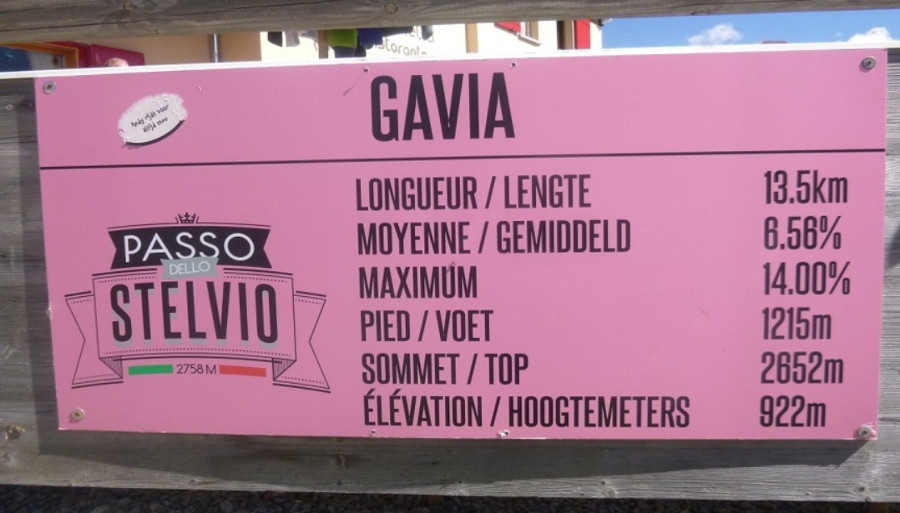
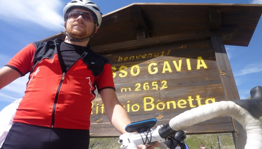
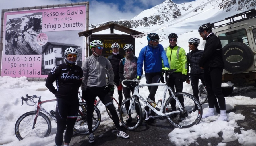
Passo Gavia – 2652m (From Santa Caterina)
This is a great climb for getting into a nice rhythm and motoring up.
The climb starts from the 13 sign on the side of the road. Unlike the other climbs that countdown the switchbacks this has signs every kilometre (starting at 0 from Bormio) to keep you counting. The summit is at or around the number 26 sign.
Leaving Santa Caterina you make your way up the side of the mountain passing under the ski lifts several times as you complete each switchback. The ride through the trees for the first 6km is very relaxing and at a nice gradient of about 6-7% which allows you to look around and take in the beauty.
Hungry? The wild raspberries that grow on the side of the road in the first 4km are great! Also a good excuse to stop if you need one.
After passing by the farm and Agriturismo (farm restaurant) the climb begins to change. From here on you are much more exposed, out of the trees and at the mercy of the elements. The road steadily climbs following the side of the mountain, up a short but nasty 14% ramp and around a corner where you will be greeted with big wall in the distance… and then you see the road going up the side of it.
My first thought was… “Oh my God” but as you continue on to your surprise and relief you find this wall is not as steep as it seems from a distance apart from the last little kick.
From here you are on the home straight. Only another 5 or so kilomenters of realtivly easy 4 – 5% roads that lead you to the top. Passing by the first Rifugio (Berni) on the right the panoramic views are amazing. Just before you reach the top you pass through 4m high snow walls (in early June) that line either side of the road which are quite spectacular and a great place for a photo.
Another 500m or so and you’re at the top where you can enjoy a well-deserved coffee in Rifugio Bonetta.
Passo Gavia (From Ponte di Legno)
A fantastic, challenging and exposed climb. If its bad weather this is not a climb to tackle. Starting from just outside Ponte di Legno this climb follows the valley for the first 4 or so kilometres with the odd steep ramp to up the heart rate.
From there it begins to make its way up the side of the mountain, through the trees. This section is quite steep with ramps of up to 16% and lasts for several kilometres… “When will it end?” you begin to think.
You eventually come out of the trees where you will be completely exposed to the element. From here there is nowhere to hide. The road winds its way along the side of the mountain but is no longer so steep and has some great views of the valley below and the mountains on the other side.
About 3km from the top you will go through a long dark tunnel (there are lights but they only guide your direction, they do not light up the tunnel). This is a good place to hide for a little if you get stuck in a thunderstorm but remember THERE IS NO PHONE SIGNAL HERE so you must push on and make it to the top. The last few kilometres to the top are leg sapping, a little steep and I can nearly guarantee you will be greeted with a lovely headwind as you exit the tunnel.
At the top you can warm up and refuel in Rifugio Bonetta before making the journey down. Well done!